Florence Update from NBAA Air Traffic Services:
Updated Sept. 10, 2018 1300 EDT
Currently, the hurricane is over 900 miles from the east coast and there is still significant ambiguity regarding its final path. The National Hurricane Center (NHC) has a “cone of uncertainty” that covers SC/NC/VA by Friday afternoon. They do note in their forecast discussion that there are still models outside this solution. As a result, operators from northern Florida through New Jersey should be paying close attention to the NHC for details on the path as it continues to narrow the impacted areas.
What does not seem to be uncertain is the expectation that this will be a major hurricane (Category III or higher, likely Category IV) by the time it does make it to the east coast.
Initial impacts will be to the routes through New York Oceanic airspace over the next 24-36 hours and will likely be handled tactically until the hurricane gets closer to shore.
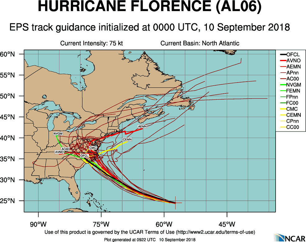
The graphic below from the National Center for Atmospheric Research shows some of the uncertainty in just one of the many ensemble forecasts used to try and determine the final track of a hurricane. This is not for flight planning use, but is specifically shown to demonstrate the level of uncertainty remaining this far out.
Resources:
- National Hurricane Center: www.nhc.noaa.gov/
- FAA OIS page: www.fly.faa.gov/ois/
- Central Pacific Hurricane Center: www.prh.noaa.gov/cphc/
- FAA Advisory Database: www.fly.faa.gov/adv/advAdvisoryForm.jsp
- FAA Current Reroutes: www.fly.faa.gov/ratreader/jsp/index.jsp
- FAA NOTAM search: notams.aim.faa.gov/notamSearch/
NBAA Airspace/Airport Alerts are informational in nature. Official current NOTAMs are available from Flight Service Stations at 1-800-WX-BRIEF. Notices, restrictions, and advisories may change at any time and without notice. Do not attempt any operation in the National Airspace System without first obtaining and understanding a thorough pre-flight briefing. In addition to talking to a FSS Specialist, operators can use the FAA NAIMES website to check for the latest TFRs. Visit https://notams.aim.faa.gov/notamSearch/ for more information about the NAIMES website.