Aug 28, 2021 – 1300z
- Overview
- Update from the National Hurricane Center
- Airport & Equipment Information
- Route Information
- Operational Resources
Overview
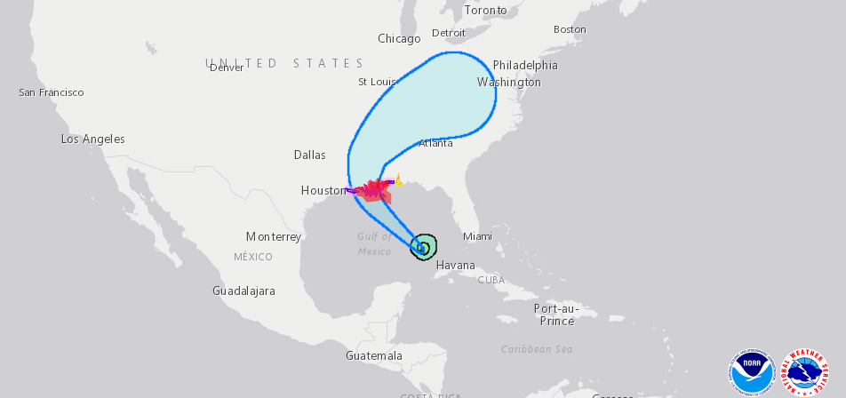
Hurricane IDA is forecast to crash into the Louisiana coastline as a Major Category 4 hurricane, with winds at the center in excess of 120 knots. The tropical storm force winds in excess of 35 knots could reach over 150 miles from the center. Outer bands of wind and rain are already impacting the western coast of Florida as IDA continues to move northwest from the southeast corner of the Gulf.
As IDA moves across the Gulf and more platforms are evacuated, we are likely to lose more of the ADS-B ground based transceivers (GBTs), which will likely lead to Gulf route closures in advance of the arrival of the storm. We also expect protective shutdowns of radars along the coast, which usually happens well in advance of landfall in order to allow the techs to safely evacuate with everyone else.
At this time we are still waiting for additional information regarding potential staffing issues, facility closures, and equipment outages. The only one we are aware of is LCH at this time, noted below. Our next update will be around 1900 ET (23z) this evening, at which time we are hoping to provide a decent picture of expected events associated with the arrival of IDA.
However, we encourage operators to follow advice of local officials, and note that the NHC has issued this note in their latest update: Actions to protect life and property should be rushed to completion in the warning area.
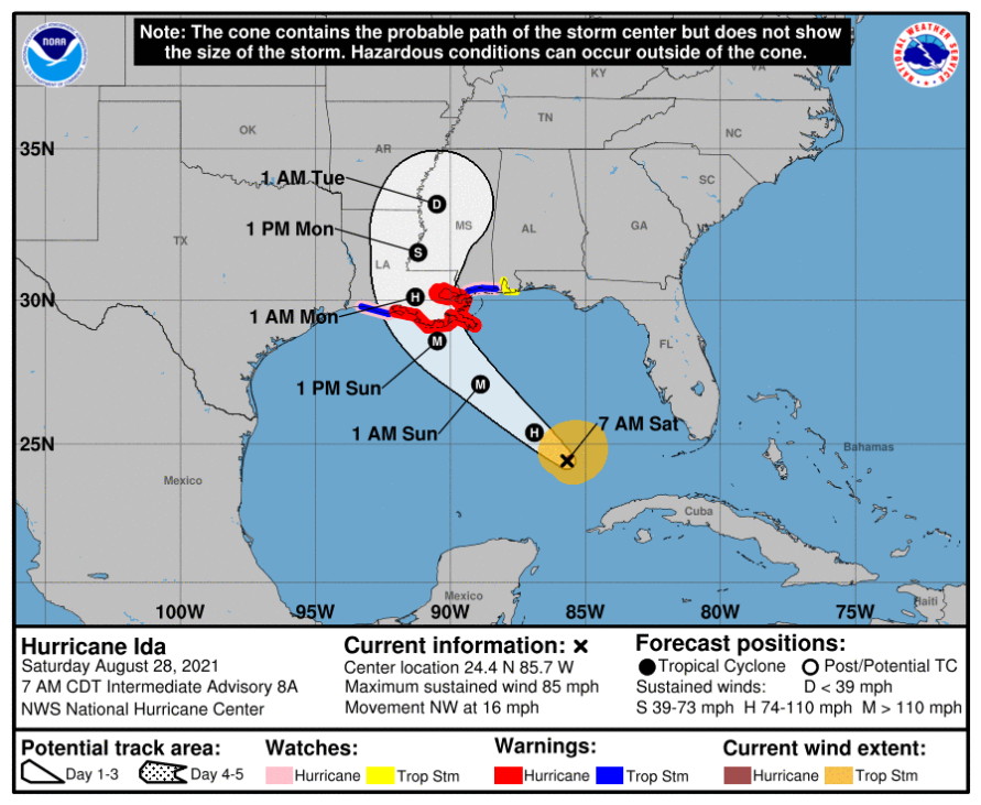
Ida – Update from the National Hurricane Center
According to the National Hurricane Center’s Advisory #8A, issued at 1200z:
At 700 AM CDT (1200 UTC), the center of Hurricane Ida was located near latitude 24.4 North, longitude 85.7 West. Ida is moving toward the northwest near 16 mph (26 km/h) and this general motion should continue through late Sunday or early Monday, followed by a slower northward motion on Monday. On the forecast track, the center of Ida will move over the southeastern Gulf of Mexico today and move over the central Gulf of Mexico tonight and early Sunday. Ida is then expected to make landfall along the U.S. northern Gulf coast within the hurricane warning area on Sunday, and then move inland over portions of Louisiana or western Mississippi later on Monday.
Maximum sustained winds have increased to near 85 mph (140 km/h) with higher gusts. Rapid strengthening is forecast during the next 24 to 36 hours and Ida is expected to be an extremely dangerous major hurricane when it approaches the northern Gulf coast on Sunday. Weakening is expected after Ida makes landfall.
Hurricane-force winds extend outward up to 25 miles (35 km) from the center and tropical-storm-force winds extend outward up to 115 miles (185 km).
The latest minimum central pressure estimated from NOAA reconnaissance aircraft data is 985 mb (29.09 inches).
Airport & Equipment Information
LCH is ATC-Zero via NOTAM at this time, currently through 20z on 8/30/21.
Kingston, Jamaica – Mt Denham radar outage, impacts noted below.
Route Notes
As IDA continues across the Gulf, we will continue to see numerous route closures. There are no required reroutes associated with IDA, and we are unlikely to see those until IDA moves inland late Sunday.
While Kingston, Jamaica Approach works to repair a Mt Denham radar outage due to Ida’s recent passage, their FMU advises that the daily traffic management measures can be avoided by filing routes through their west sector. They advise that traffic management initiatives only apply to aircraft that file through their east sector; if you have the option, it is advised to file west sectors inbound to the island, around the area impacted by the outage.