Discussion and 48-hour Outlook from the National Hurricane Center:
Aug 25, 2018
This will be our final update for Tropical Storm LANE, which is expected to weaken to a depression no later than Monday morning. It is also moving west, away from the islands, as it continues to weaken, which is why the Central Pacific Hurricane Center (CPHC) has discontinued any tropical storm watches or warnings.
Discussion and Outlook from the National Hurricane Center:
According to the National Hurricane Center’s Advisory #46, issued at 2100z:
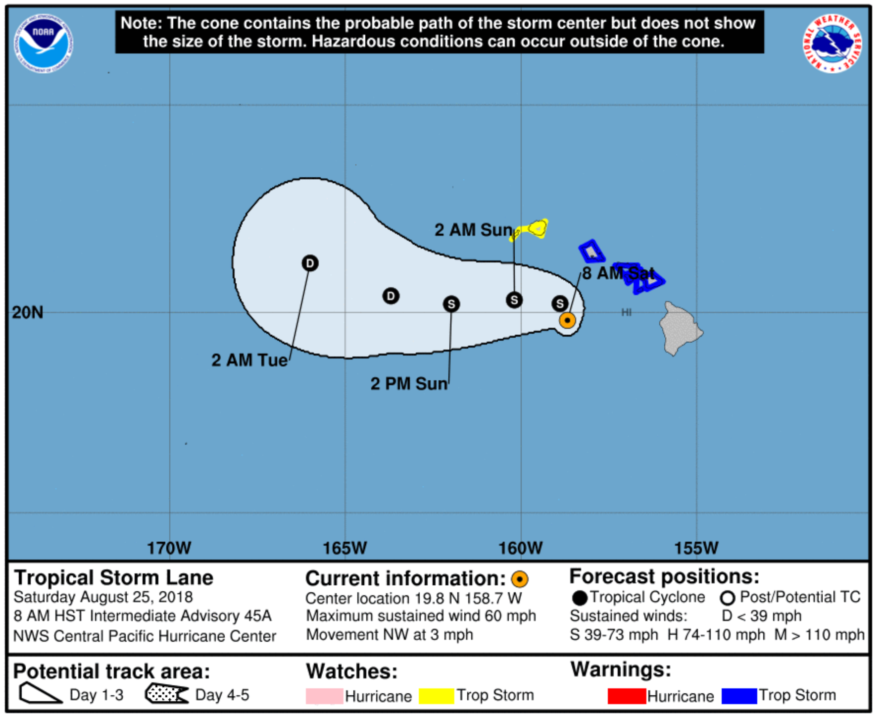
At 1100 AM HST (2100 UTC), the center of Tropical Storm Lane was located near latitude 19.7 North, longitude 159.4 West. Lane is moving toward the west near 7 mph (11 km/h) and this motion is expected to continue this afternoon through Monday with an increase in forward speed. On the forecast track, Lane is expected to pass about 150 miles south of Kauai later today.
Maximum sustained winds are near 50 mph (85 km/h) with higher gusts. Some weakening is forecast during the next 48 hours.
Tropical-storm-force winds extend outward up to 100 miles (155 km) from the center.
The estimated minimum central pressure is 997 mb (29.44 inches).
Airport & Equipment notes:
There have been no significant airport, personnel or facility issues reported throughout this event. Continued rains associated with the passage of LANE could still bring localized flooding events, but we’re not expecting significant infrastructure impacts at this time. In addition to checking NOTAMs, we also suggest calling your FBO fo choice in order to confirm staffing and services available.
*** NOTAMs are your best source of information regarding airport and facility status. ***
Route notes:
No route issues as a result of this storm.
Resources
- FAA OIS page: http://www.fly.faa.gov/ois/
- Central Pacific Hurricane Center: http://www.prh.noaa.gov/cphc/
- FAA Advisory Database: http://www.fly.faa.gov/adv/advAdvisoryForm.jsp
- FAA Current Reroutes: http://www.fly.faa.gov/ratreader/jsp/index.jsp
- FAA NOTAM search: https://notams.aim.faa.gov/notamSearch/