Updated Nov. 9. 2022 – 1400z
- Overview
- Update from the National Hurricane Center
- Airport & Equipment Information
- Route Information
- Operational Resources
- NBAA’s HERO Database
Overview
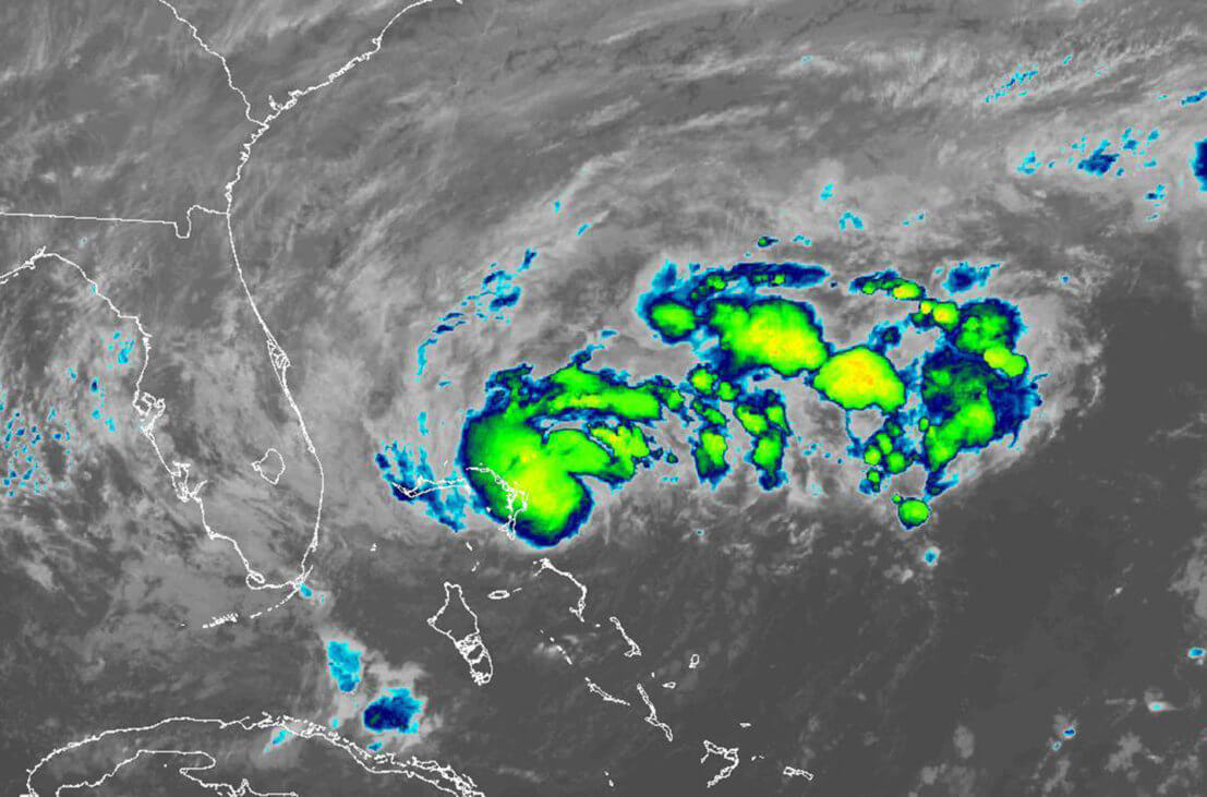
Tropical Storm Nicole is approaching landfall on the east coast of Florida and projected to come ashore north of the Miami Metro on Thursday, Nov. 10 at 1 a.m. (0600z). Nicole is currently located 240 miles east of West Palm Beach, FL with maximum sustained winds of 70+ knots, with expected strengthening before landfall.
Hurricane conditions and a dangerous storm surge are expected in portions of the northwestern Bahamas today, where a Hurricane Warning is in effect. Hurricane conditions are expected across portions of the coast of southeast and east-central Florida beginning this evening or tonight, where a Hurricane Warning is in effect.
Tropical storm conditions have begun along the east coast of Florida in the warning areas and will spread northward to Georgia and South Carolina later today. Tropical storm conditions are expected to begin along the east coast of Florida within the warning area this evening.
There are numerous airport closures – 16 at present count – and ATC reductions of service in place, with more expected today.
Update from the National Hurricane Center
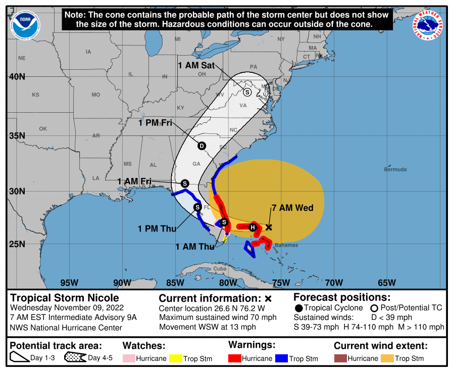
According to the National Hurricane Center’s Advisory #9A, issued at 1200z:
At 700 AM EST (1200 UTC), the center of Tropical Storm Nicole was located near latitude 26.6 North, longitude 76.2 West. Nicole is moving toward the west-southwest near 13 mph (20 km/h). A turn toward the west is expected today, followed by a turn toward the northwest on Thursday, and north or north-northeast on Friday. On the forecast track, the center of Nicole will approach the northwestern Bahamas this morning, move near or over those islands by midday, and approach the east coast of Florida within the hurricane warning area tonight. Nicole’s center is then expected to move across central and northern Florida into southern Georgia Thursday and Thursday night, and then across the Carolinas Friday and Friday night.
Maximum sustained winds are near 70 mph (110 km/h) with higher gusts. Some strengthening is expected today, and Nicole is forecast to become a hurricane near the northwestern Bahamas and remain a hurricane when it reaches the east coast of Florida tonight. Nicole is expected to weaken while moving across Florida and the southeastern United States Thursday through Friday, and it is likely to become a post-tropical cyclone by Friday night over the Mid-Atlantic states.
Nicole is a large tropical storm. Tropical-storm-force winds extend outward up to 460 miles (740 km) especially to the north of the center. During the past few hours, a National Ocean Service station at the Lake Worth Pier, Florida, reported sustained winds of 44 mph (71 km/h) and a wind gust of 55 mph (89 km/h).
The minimum central pressure reported by a NOAA Hurricane Hunter aircraft is 986 mb (29.12 inches).
Airport & Equipment Information
ATC Reductions in Service
- West Palm Beach ATCT (ATC Zero)
Airport Closures – Present and Upcoming
- BCR – Tri-County Airport
- COI – Merritt Island Airport
- DAB – Daytona Beach International Airport
- F45 – North Palm Beach County General Aviation Airport
- ISM – Kissimmee Gateway Airport
- LNA – Palm Beach County Park Airport
- MCO – Orlando International Airport
- MLB – Melbourne Orlando International Airport
- ORL – Executive Airport
- PBI – Palm Beach International Airport
- PHK – Palm Beach County Glades Airport
- SFB – Orlando Sanford International Airport
- TIX – Space Coast Regional Airport
- TNT – Dade-Collier Training and Transition Airport
- X21 – Arthur Dunn Air Park
- X36 – Buchan Airport
Route Information
Route structure, CDRs/SWAP, escape routes in/out of Florida via the west coast are possible today. AR closures are probable.
Operational Resources
- National Hurricane Center
- FAA OIS page
- CADENA OIS page
- FAA Advisory Database
- FAA Current Reroutes
- FAA NOTAM Search
NBAA’s HERO Database
The NBAA Humanitarian Emergency Response Operator (HERO) Database is a list of people in the business aviation community who are part of disaster-response mobilization efforts. In the aftermath of major crises, basic information from the database is provided to organizations coordinating relief efforts. Learn more and register.