Feb. 3, 2022
The FAA this week launched a new, interactive map to provide operators with live, up-to-the-minute information for 87 airports where deployment of 5G network transmitters may affect landings in instrument meteorological conditions.
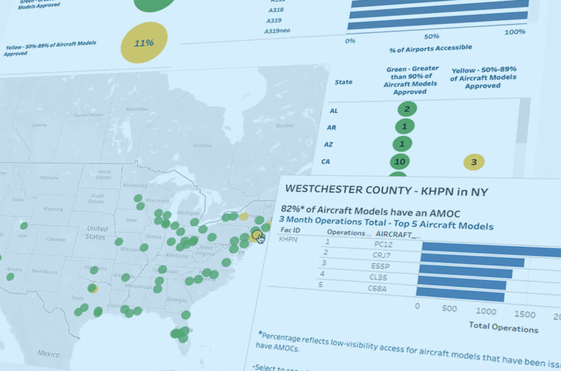
The map, available at www.faa.gov/5g, allows users to select specific aircraft types, airports and runways to determine if low visibility landings are permitted, in consideration of potential 5G interference on radar altimeters installed in many commercial aircraft, including business aircraft.
Most airports on the map are shown in green, denoting greater than 90% of the most common aircraft types – including many business aircraft – with either an approved radar altimeter or an alternative means of compliance (AMOC) to operate in areas with active 5G networks. Yellow indicates facilities with AMOCs for between 50-89% of aircraft using that facility.
“The FAA created this resource in direct response to industry requests for updated and geographically-targeted information about the ongoing 5G deployment,” said Heidi Williams, NBAA senior director for air traffic services and infrastructure. “However, NOTAMs remain the best source for detailed information about specific impacts to business aviation operations from possible 5G interference.”
To date, the FAA has approved 20 radar altimeters for use in 5G environments, allowing “approximately 90% of the U.S. commercial fleet to perform low-visibility landings” at affected airports. Airports not shown on the map are likely either not in a 5G area, the agency added, or do not yet have runway systems able to support IMC landings without use of radar altimeter data.