Updated Nov. 9. 2022 – 2330z
- Overview
- Update from the National Hurricane Center
- Airport & Equipment Information
- Route Information
- Operational Resources
- NBAA’s HERO Database
Overview
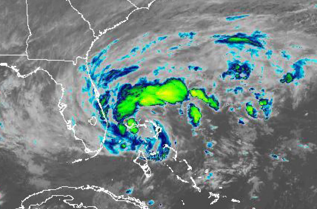
Hurricane Nicole is located about 135 miles east from West Palm Beach, FL moving toward the west near 13 mph. A turn toward the west-northwest is expected tonight, followed by a turn toward the northwest on Thursday, and north or north-northeast on Friday.
On the forecast track, the center of Nicole will move onshore on the east coast of Florida within the hurricane warning area tonight. Nicole’s center is then expected to move across central and northern Florida into southern Georgia Thursday, and then across the Carolinas on Friday.
Update from the National Hurricane Center
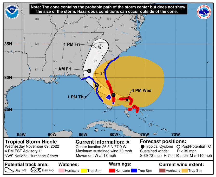
According to the National Hurricane Center’s Advisory #11, issued at 2100z:
At 400 PM EST (2100 UTC), the center of Hurricane Nicole was located near latitude 26.5 North, longitude 77.9 West. Nicole is moving toward the west near 13 mph (20 km/h). A turn toward the west-northwest is expected tonight, followed by a turn toward the northwest on Thursday, and north or north-northeast on Friday. On the forecast track, the center of Nicole will move near or over Grand Bahama Island in the northwestern Bahamas this evening, and move onshore the east coast of Florida within the hurricane warning area tonight. Nicole’s center is then expected to move across central and northern Florida into southern Georgia Thursday and Thursday night, and into the Carolinas Friday.
Maximum sustained winds are near 70 mph (110 km/h) with higher gusts. Some strengthening is expected this evening, and Nicole is forecast to become a hurricane before it reaches the east coast of Florida tonight. Nicole is expected to weaken while moving across Florida and the southeastern United States Thursday through Friday, and it is likely to become a post-tropical cyclone by Friday afternoon.
Nicole is a large Hurricane. Tropical-storm-force winds extend outward up to 485 miles (780 km) from the center, especially to the north of the center. A NOAA Coastal Marine Observing Site at Settlement Point on the west end of Grand Bahama Island has recently reported sustained winds of 40 mph (64 km/h) and a wind gust of 54 mph (87 km/h). A private weather station on Elbow Cay, just east of Great Abaco Island, recently reported sustained winds of 46 mph (74 km/h) and a wind gust of 64 mph (103 km/h).
The estimated minimum central pressure is 985 mb (29.09 inches).
Airport & Equipment Information
Airport Closures – Present and Upcoming
- BCR – Tri-County Airport
- COI – Merritt Island Airport
- DAB – Daytona Beach International Airport
- F45 – North Palm Beach County General Aviation Airport
- ISM – Kissimmee Gateway Airport
- LNA – Palm Beach County Park Airport
- MCO – Orlando International Airport
- MLB – Melbourne Orlando International Airport
- ORL – Orlando Executive Airport
- PBI – Palm Beach International Airport
- PHK – Palm Beach County Glades Airport
- SFB – Orlando Sanford International Airport
- TIX – Space Coast Regional Airport
- TNT – Dade-Collier Training and Transition Airport
- X21 – Arthur Dunn Air Park
- X36 – Buchan Airport
Protective Shutdowns
- ORLANDO, FL (MCO) ASDE UFN.
- ORLANDO, FL (MCO) ASR UFN.
- ORLANDO, FL (MCO) RWSL UFN.
- WHITEHOUSE, FL (NEN) NDAG UFN.
Route Information
Route structure, CDRs/SWAP, escape routes in and out of Florida via the west coast are possible today. AR closures are probable.
Operational Resources
- National Hurricane Center
- FAA OIS page
- CADENA OIS page
- FAA Advisory Database
- FAA Current Reroutes
- FAA NOTAM Search
NBAA’s HERO Database
The NBAA Humanitarian Emergency Response Operator (HERO) Database is a list of people in the business aviation community who are part of disaster-response mobilization efforts. In the aftermath of major crises, basic information from the database is provided to organizations coordinating relief efforts. Learn more and register.